This is a continuation pf the Augmenting History posting I stared a few weeks back.
This entry adds some more details around how the editing tools could work as well as some more applications of the technology.
Adding Datasets
The Web-Based Editor
User will be able to enter Datasets in to either a web-based or mobile client. These Datasets may be classified as either ‘Free’ or ‘Premium’ with premium sets being made available for a small download fee.
For example, if a user wants to download a premium Dataset such as the ‘Official National Park Dataset’ (vetted and accurate) they will pay $0.99. Alternately, they would also have the flexibility to use an anonymous user’s dataset for free if desired.
All Datasets can have ‘subsets’ which, in concept, act as ‘pages’ of sorts in the parent (main) Dataset container. More details around subsets are included below.
Editing & Creating Data Sets
Users begin by naming their datasets and filling out information about the historical event - an overview of the event (if they desire)
They can then add subsets to their dataset. These are like the pages of a book, each one is independent, but is contained within the parent dataset.
Editing & Creating Data Subsets
Data subsets can be time based, groupings (e.g union, rebel) or general (organized by the user).
Time based subsets will include a playback control on the client when users are viewing these types of datasets. This will allow users to step through/play back time, whether that means advancing through the subsets by minutes, days or years etc.
Subsets that are of the type ‘Grouping’ and ‘General’ don’t have any associated time-based (playback) UI controls, but would be filterable via UI controls like any other subset.
All subsets can be filtered when viewing the data on the mobile client.
Nested subsets (subsets of subsets) will be allowed but only to a level of 1 nesting. For example, ‘day 1 of a battle’ may contain subsets for groups of combatants.
Data Points
Data points will consist of latitude, longitude and altitude (if input by the user)
Data points are also organized into the following types which will dictate their in-app behavior and the types of data that can be associated with them:
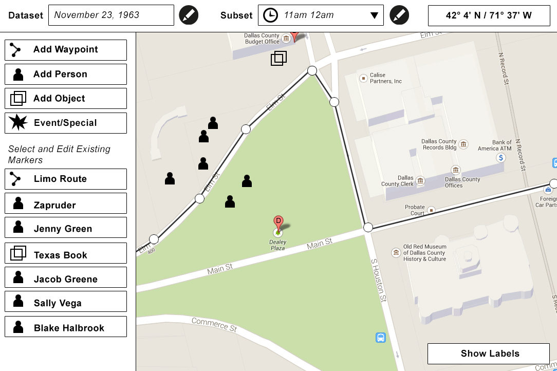 Users can add data points based by simply selecting the data point type, clicking on the map and entering some data for the data point. They can also move (edit) data points on the UI by simply clicking and dragging. (Latitude and Longitude appear on the UI and dynamically update as the user moves a datapoint.
Alternately they could also type in GPS coordinates and click add for exact placement.
Note- the mobile editing client would have a ‘live mode’ so users could add data points to their exact/current locations by simply tapping the screen. This way they could walk specific routes in buildings etc and create data.
Concerning altitude, users will also be be able to type in/estimate altitude for a given point. (This would, for example, allow them to properly map a path up a staircase)
IDEA: Specialty objects like ‘ghosts’ may be made available in future iterations for fun events such as ghost tours.
More Examples on the Mobile Client
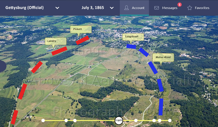
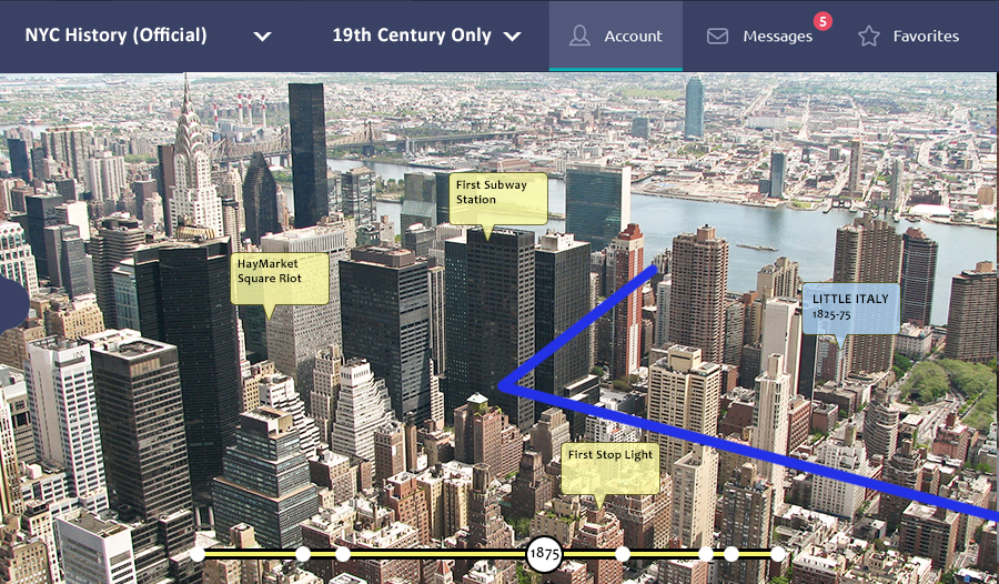
Aerial Tourism
History is often ‘too big’ to be completely experienced by a walking tour. Aerial and skyline tours could include Augmented History to help enhance the user experience.
For example, a helicopter tour could actually fly riders along a re-creation of the path John Wilkes Booth used to escape from Washington D.C ir over Day 2 of the Battle of Gettysburg.
Or maybe they could take a skyline tour of New York City and advance through the years and see how the City evolved over time or where specific historical events happened.